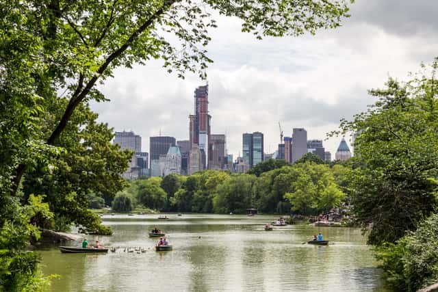
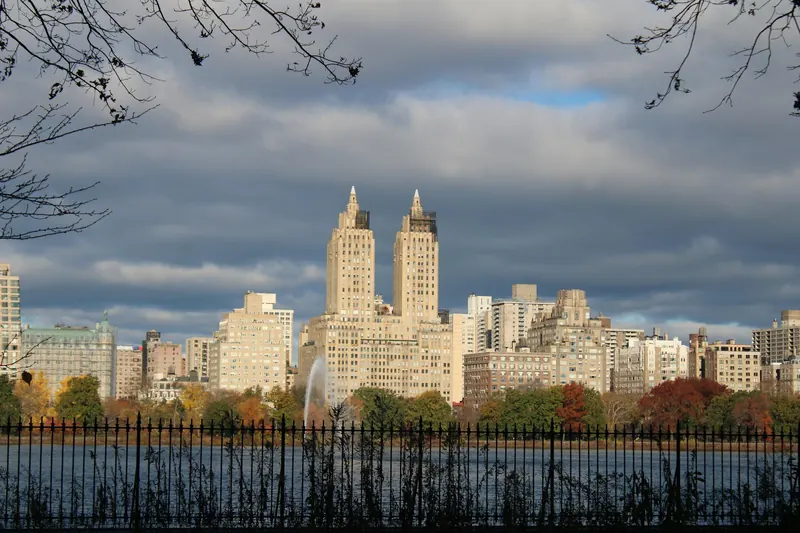
New York
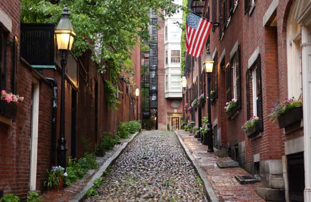
Boston

Washington
United States · Multi-city itinerary
US Northeast itinerary — April 2027
By Tripsapien Research · Updated May 20, 2026
April 2027 is a good time for the US Northeast trip (New York, Boston & Washington). Daytime highs run from about 14°C / 57°F to 20°C / 68°F across the stops. Plan around 9–11 days for the full New York, Boston & Washington loop. Tripsapien checks every place on your list against your exact dates — hours, closures and booking pressure at each stop.
The route
About 9–11 days · 3 cities
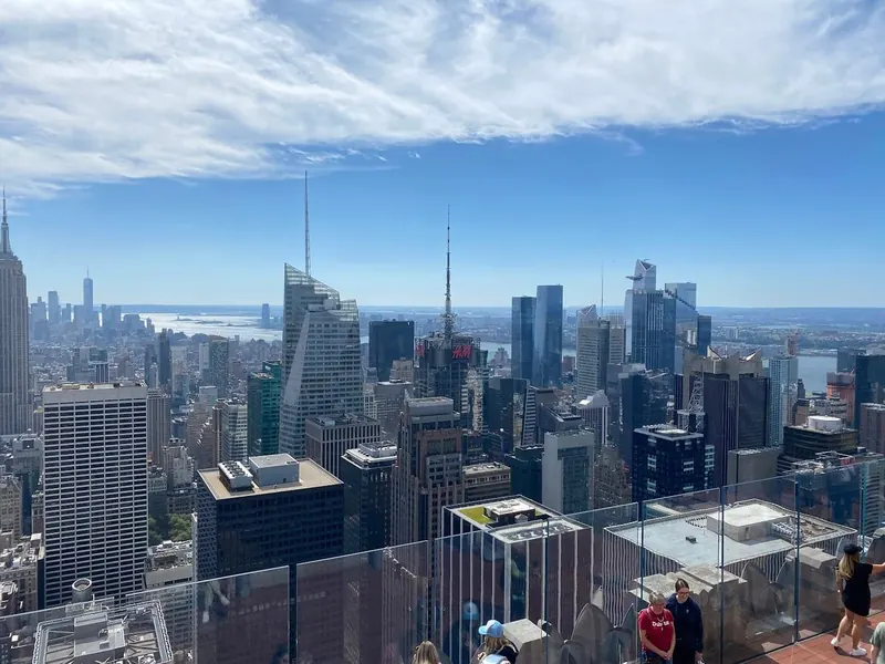
The northeast corridor's big three, linked by Amtrak's Acela: New York City, historic, walkable Boston, and the monuments and museums of Washington, DC. New York sits in the middle, an easy hub for the whole loop.
New York
New York in April
Temperature
59°F / 46°F
15°C / 7.5°C
Precipitation
15d
3.6in · 92.3mm
Daylight
13.1h
Sea
48.6°F
9.2°C
April turns mild enough for Brooklyn Bridge and High Line walks, while Brooklyn Botanic Garden CherryWatch and Hanami Nights around the Cherry Esplanade make Prospect Park planning matter.
April turns mild enough for Brooklyn Bridge and High Line walks, while Brooklyn Botanic Garden CherryWatch and Hanami Nights around the Cherry Esplanade make Prospect Park planning matter.
City overview
New York is a five-borough harbor city where Manhattan, Brooklyn, Queens, the Bronx, and Staten Island sit between the Hudson River, East River, and Upper New York Bay. For first-time planning, Manhattan is the spine: the numbered grid begins above 14th Street, while Greenwich Village, SoHo, the Lower East Side, Chinatown, and Lower Manhattan keep older pre-grid lanes closer to the harbor.
Food & drink
New York food is tied to blocks: NY-style pizza by the slice, bagels with lox and cream cheese, pastrami on rye, halal-cart chicken-and-rice, Chinatown dim sum, black-and-white cookies, cheesecake, and deli pickles all have local routes. Russ & Daughters at 179 East Houston Street, Katz's Delicatessen at 205 East Houston Street, Mott Street and Mulberry Street in Chinatown and Little Italy, Chelsea Market, and Smorgasburg in Williamsburg make a practical first food map.
Top sights
Ranked for April suitability using weather, setting, ratings, and review volume.
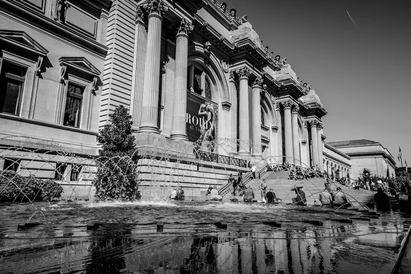
- 1Metropolitan Museum of Art
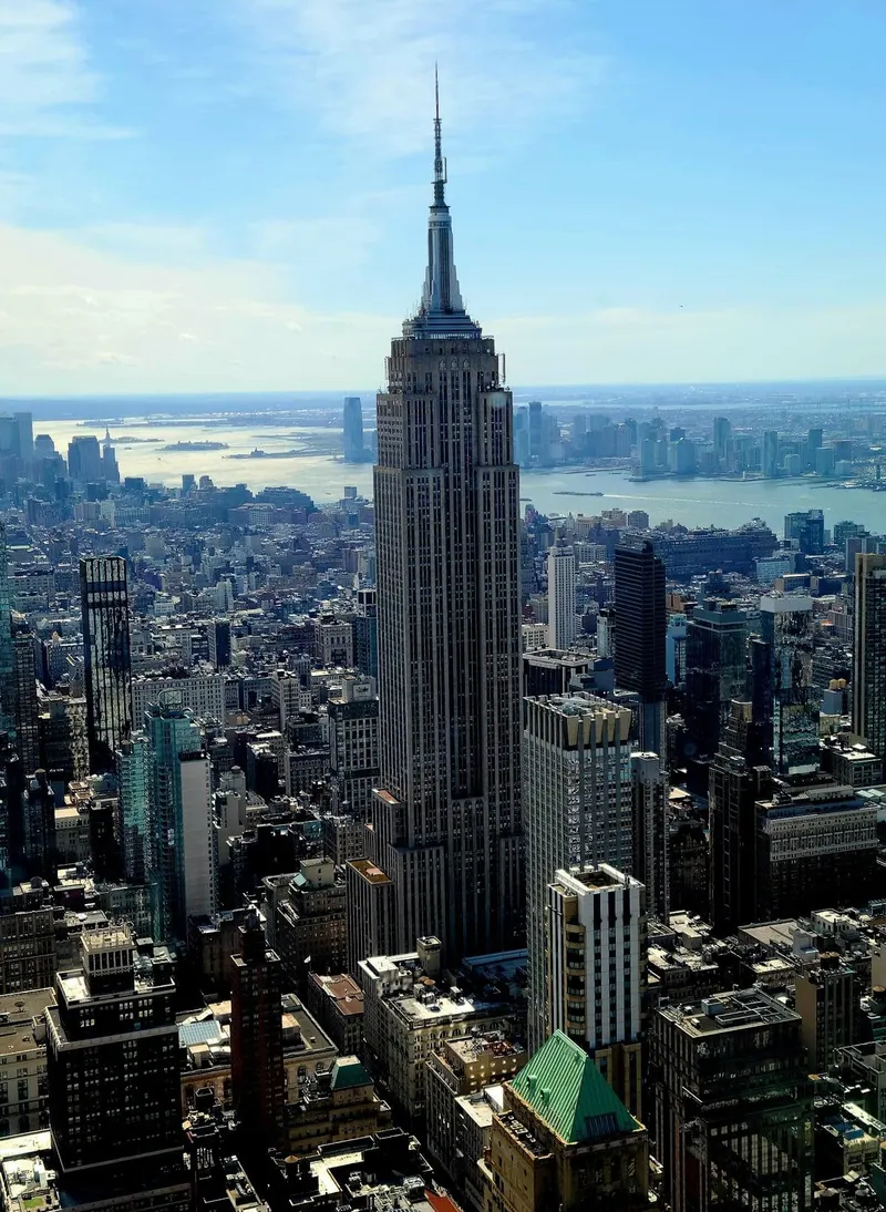
- 2Empire State Building
- 3Top of the Rock & Rockefeller Center
- 4American Museum of Natural History
- 59/11 Memorial & Museum
- 6Central Park
- 7Brooklyn Bridge
- 8Times Square & Theater District
- 9The High Line
- 10Statue of Liberty & Ellis Island
 1
1Metropolitan Museum of Art
4.8★ · 92,841indoorClosed WedThe Met was founded in 1870 and anchors Fifth Avenue at 82nd Street, beside Central Park and the Museum Mile stretch of the Upper East Side. The 86 St station on the 4/5/6 is the closest major subway stop, with a crosstown walk past the park wall.
WikipediaThe permanent collection is too large for one pass; choose Greek and Roman art, Egyptian art, or the American Wing before adding special exhibitions.
 2
2Empire State Building
4.7★ · 127,127indoorOpen dailyThe 1931 Art Deco tower rises at 350 Fifth Avenue, two blocks south of Herald Square and a short walk from Bryant Park. The nearest subway cluster is 34 St-Herald Sq on the B/D/F/M/N/Q/R/W, with 33 St on the 6 train another practical arrival.
WikipediaSunset observatory slots sell out first; late-night entries usually mean shorter elevator queues.
 3
3Top of the Rock & Rockefeller Center
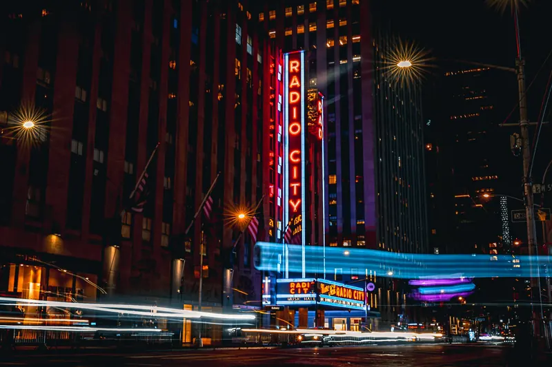
4.7★ · 82,606indoorOpen dailyRockefeller Center opened in 1933 around 30 Rockefeller Plaza, Radio City Music Hall, Channel Gardens, and the Fifth Avenue side of Midtown. The 47-50 Sts-Rockefeller Center station on the B/D/F/M is underneath the complex, with St. Patrick's Cathedral and MoMA close by.
Top of the Rock sunset tickets are the scarce window; daytime visits give clearer views toward Central Park.
Show 7 more sights
- 4American Museum of Natural History
- 59/11 Memorial & Museum
- 6Central Park
- 7Brooklyn Bridge
- 8Times Square & Theater District
- 9The High Line
- 10Statue of Liberty & Ellis Island
Neighborhoods
 1
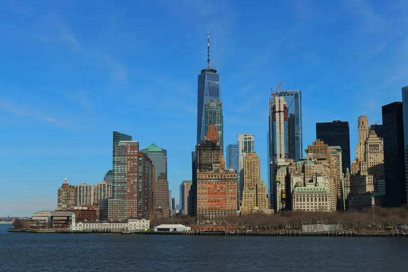
1Lower Manhattan, Financial District, Battery Park & Tribeca
The harbor end of Manhattan feels older and tighter, with Wall Street, Stone Street, the Battery, the Staten Island Ferry terminal, One World Trade Center, and cobbled Tribeca blocks around Harrison Street. It is the best base for the Statue of Liberty ferry, the 9/11 Memorial, and a Brooklyn Bridge walk.
 2
2SoHo, NoLita & Lower East Side
SoHo is cast-iron lofts on Greene, Mercer, and Broadway; NoLita shifts smaller around Elizabeth and Mulberry streets; the Lower East Side adds Orchard Street, Ludlow Street, Essex Market, and the Tenement Museum. The Delancey Street-Essex Street F/J/M/Z hub makes this side easy to pair with Chinatown.
 3
3Greenwich Village, West Village & Meatpacking District
Greenwich Village keeps the crooked pre-grid street pattern around Washington Square Park, MacDougal Street, Bleecker Street, and Christopher Street-Sheridan Square. West of Seventh Avenue, the West Village narrows into townhouse lanes before the Meatpacking District reaches Gansevoort Street, the Whitney, and the High Line entrance.
 4
4Midtown, Times Square, Rockefeller Center & Fifth Avenue
Midtown is the visitor-heavy spine: Grand Central Terminal, Bryant Park, the New York Public Library, Times Square, Broadway theaters, Rockefeller Center, St. Patrick's Cathedral, and Fifth Avenue shopping sit within a few avenue blocks. It is crowded, bright, and practical when trains at Penn Station or Grand Central shape the day.
 5
5Upper East Side, Upper West Side & Central Park
The park divides two museum-and-apartment districts: the Upper East Side has the Met, Guggenheim, Frick, and 86 St 4/5/6 access, while the Upper West Side has Lincoln Center, AMNH, Zabar's, and 81 St B/C access. Crossing at 79th Street or the Great Lawn makes the pair feel closer than the subway map suggests.
 6
6Brooklyn: DUMBO, Brooklyn Heights & Williamsburg
DUMBO puts cobblestones, Washington Street bridge photos, Brooklyn Bridge Park, and East River skyline views below the Manhattan Bridge. Brooklyn Heights adds the Promenade and brownstone streets, while Williamsburg centers on Bedford Avenue, the L train, Smorgasburg-season waterfront crowds, and East River ferry stops.
Getting around
The MTA subway is the visitor backbone: OMNY tap-to-pay works with contactless cards, phones, watches, and OMNY Cards, the current subway and local bus fare is $3, and using the same card or device caps subway/local bus rides at $35 after 12 paid fares in 7 days. Subway trains run 24 hours a day, 7 days a week, but late-night service patterns change; Penn Station, Grand Central, Atlantic Terminal, JFK, LGA, and EWR all need separate airport or rail timing.
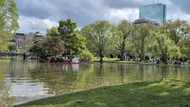
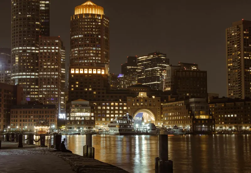
Boston
Boston in April
Temperature
56°F / 41°F
13.6°C / 4.9°C
Precipitation
12d
3.5in · 90mm
Daylight
13.2h
Sea
44.6°F
7°C
April brings marathon energy on Patriots Day, blooming Public Garden paths, and changeable rain on the Back Bay route.
April brings marathon energy on Patriots Day, blooming Public Garden paths, and changeable rain on the Back Bay route.
City overview
Boston sits on Massachusetts Bay where colonial wharves, reclaimed Back Bay blocks, and Charles River campuses meet in a compact walking city. Downtown, Beacon Hill, Back Bay, the North End, Fenway, and Cambridge give a first-time visitor the working map: Revolution sites, brownstones, universities, ballparks, and harbor edges.
Food & drink
Boston food is New England seafood plus old neighborhood bakeries: clam chowder is cream-based with clams and potatoes, lobster rolls serve cold lobster salad or warm buttered meat in a split-top bun, baked beans point to molasses-and-pork colonial cooking, and raw bars focus on oysters. The North End pastry rivalry between Mike's Pastry and Modern Pastry is a standard stop, while Union Oyster House, Quincy Market, Seaport raw bars, and North Shore roast-beef shops cover the old-to-new route.
Top sights
Ranked for April suitability using weather, setting, ratings, and review volume.
- 1Boston Common and Public Garden
- 2MIT and Kendall Square
- 3Fenway Park
- 4Museum of Fine Arts, Boston
- 5USS Constitution and Charlestown Navy Yard
- 6Isabella Stewart Gardner Museum
- 7Boston Tea Party Ships and Museum
- 8Faneuil Hall and Quincy Market
- 9Freedom Trail
- 10Harvard Yard and Harvard Square
 1
1Boston Common and Public Garden
4.8★ · 18,598outdoorBoston Common dates to 1634, making it the oldest public park in the United States, and the adjacent Public Garden opened in 1837 with the Swan Boats lagoon. Park Street and Arlington stations bracket the green space.
Wikipedia 2
2MIT and Kendall Square
4.1★ · 113outdoorMIT moved from Boston to Cambridge in 1916, and its campus mixes the Great Dome, Stata Center, List Visual Arts Center, and labs around Massachusetts Avenue. Kendall/MIT station links it to downtown Boston in two Red Line stops.
 3
3Fenway Park
4.8★ · 45,047mixedThe Red Sox ballpark opened in 1912 and preserves the Green Monster left-field wall, manual scoreboard, and narrow Yawkey Way-era footprint. Kenmore station is a short walk across Brookline Avenue.
WikipediaTours run on non-game days and sell fastest on summer weekends.
Show 7 more sights
- 4Museum of Fine Arts, Boston
- 5USS Constitution and Charlestown Navy Yard
- 6Isabella Stewart Gardner Museum
- 7Boston Tea Party Ships and Museum
- 8Faneuil Hall and Quincy Market
- 9Freedom Trail
- 10Harvard Yard and Harvard Square
Neighborhoods
 1
1Downtown and Waterfront
Downtown is historic and busy, with Boston Common, Government Center, Old State House, Faneuil Hall, Long Wharf, the Aquarium, and ferries packed into short walks.
 2
2North End
The North End is tight and Italian-American, with Paul Revere House, Old North Church, Hanover Street restaurants, Modern Pastry, and Mike's Pastry queues.
 3
3Beacon Hill
Beacon Hill is brick, gas lamps, and steep sidewalks, anchored by the Massachusetts State House, Acorn Street, Charles Street shops, and the edge of Boston Common.
 4
4Back Bay
Back Bay is the 19th-century reclaimed grid, with Commonwealth Avenue mall, Newbury Street, Copley Square, Trinity Church, Boston Public Library, and Prudential Center views.
 5
5Fenway and Kenmore
Fenway mixes Red Sox crowds, the MFA, Isabella Stewart Gardner Museum, student apartments, Lansdowne Street bars, and the Emerald Necklace park chain.
 6
6Cambridge: Harvard Square and Kendall Square
Cambridge works as a traveler neighborhood, with Harvard Yard, bookstores, MIT labs, Kendall Square restaurants, and Red Line stations two to five stops from Boston Common.
Getting around
The MBTA subway is the T, with Red, Orange, Blue, Green, and Silver Line routes using CharlieCard or contactless Charlie fare gates. Walk the historic core, use the Red Line for Cambridge, the Green Line for Back Bay and Fenway, and the Blue Line for Logan Airport via the free Massport shuttle.
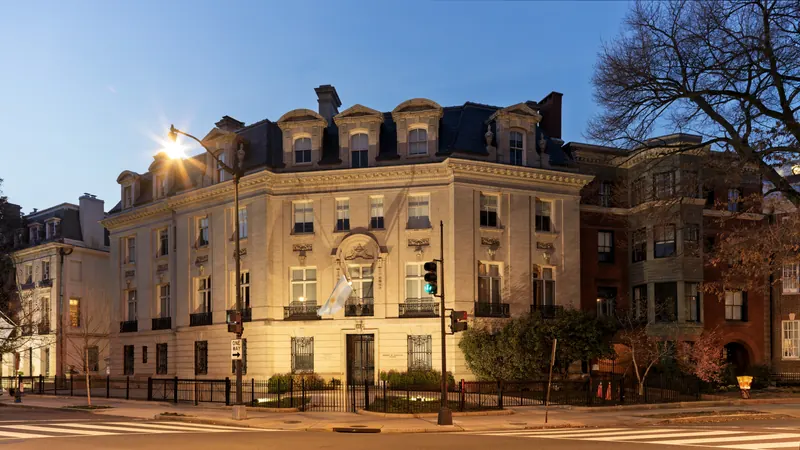
Washington
Washington in April
Temperature
67°F / 47°F
19.4°C / 8.6°C
Precipitation
15d
3.4in · 87.1mm
Daylight
12.7h
April is peak spring, with Cherry Blossom Festival crowds and comfortable monument walking.
April is peak spring, with Cherry Blossom Festival crowds and comfortable monument walking.
City overview
Washington, DC is a planned capital on the Potomac where the National Mall, federal buildings, free Smithsonian museums, neighborhood nightlife, and embassy rows sit inside a compact district. The Mall is the first-time anchor, but Capitol Hill, Georgetown, Dupont Circle, U Street, Shaw, Adams Morgan, and the Wharf carry much of the city beyond monuments.
Food & drink
DC food starts with counter-service classics and immigrant dining: a half-smoke is a smoky sausage split into a bun with chili, onions, and mustard, mumbo sauce glosses fried wings and carryout chicken, Ethiopian meals spread stews over injera, and Salvadoran pupusas arrive as griddled corn cakes with curtido. Ben Chili Bowl on U Street, Eastern Market, Union Market, Adams Morgan, Mount Pleasant, and Eden Center outside the district add crab cakes, jumbo slices, food-hall counters, and power-lunch rooms.
Top sights
Ranked for April suitability using weather, setting, ratings, and review volume.
- 1National Museum of African American History and Culture
- 2National Gallery of Art
- 3Library of Congress
- 4National Air and Space Museum
- 5National Mall
- 6Lincoln Memorial
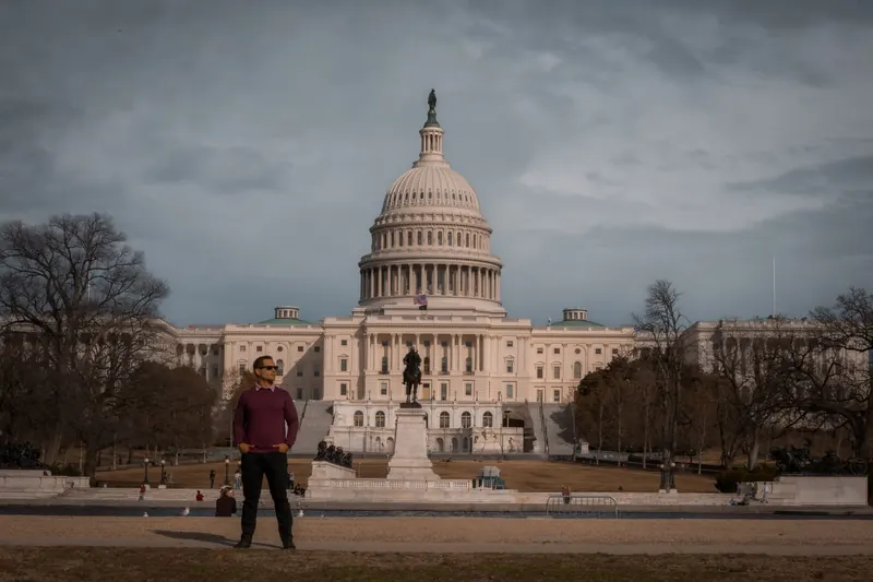
- 7US Capitol
- 8Washington Monument
- 9Georgetown waterfront and C&O Canal
- 10White House and Lafayette Square
 1
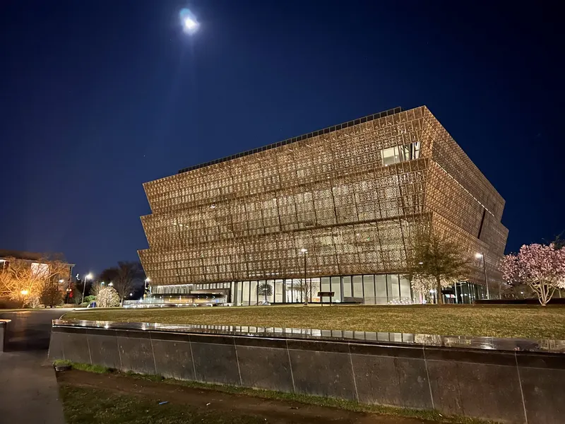
1National Museum of African American History and Culture
4.8★ · 30,561indoorOpen dailyThe Smithsonian museum opened in 2016 and traces African American life, slavery, segregation, culture, and politics. Timed entry is often required during busy periods.
Wikipedia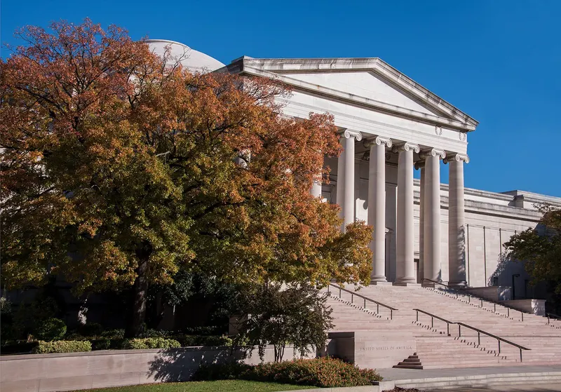 2
2National Gallery of Art
4.8★ · 20,247indoorOpen dailyThe West Building, East Building, sculpture garden, and underground concourse cover European painting, American art, modern collections, and outdoor skating in winter.
Wikipedia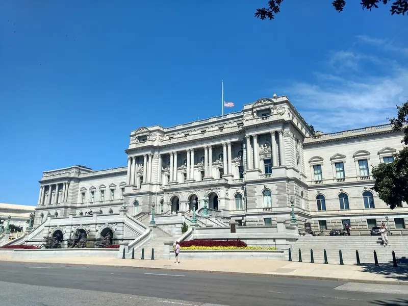 3
3Library of Congress
4.8★ · 3,507indoorClosed Mon/SunThe Jefferson Building is one of the city most ornate interiors, with mosaics, marble staircases, exhibitions, and a view into the Main Reading Room. It sits across from the Capitol.
Wikipedia
Show 7 more sights
- 4National Air and Space Museum
- 5National Mall
- 6Lincoln Memorial
- 7US Capitol
- 8Washington Monument
- 9Georgetown waterfront and C&O Canal
- 10White House and Lafayette Square
Neighborhoods
 1
1National Mall and Federal Triangle
This is monumental DC, with museums, memorials, federal offices, long lawns, security lines, food trucks, and heavy daytime walking.
 2
2Capitol Hill and Eastern Market
Capitol Hill mixes government buildings, row houses, Eastern Market, Barracks Row, parks, and quieter residential streets east of the Capitol.
 3
3Georgetown
Georgetown is historic and polished, with brick sidewalks, shops, the university, canal paths, waterfront restaurants, and limited Metro access.
 4
4Dupont Circle and Embassy Row
Dupont is international and social, with embassies, museums, bookstores, restaurants, bars, and red-line Metro access.
 5
5U Street, Shaw, and Logan Circle
This central nightlife belt carries Black music history, theaters, restaurants, cocktail bars, row houses, and busy weekend sidewalks.
 6
6Adams Morgan, Columbia Heights, and Mount Pleasant
The northwest neighborhoods feel multilingual and late-night, with row-house streets, global restaurants, music bars, plazas, and Rock Creek Park edges.
Getting around
WMATA Metrorail, Metrobus, SmarTrip cards, Capital Bikeshare, and walking cover most visitor routes, with Metro strongest for the Mall edges, Capitol Hill, Dupont, U Street, and airports. Georgetown and late-night cross-town moves often need a bus, bike, taxi, or ride-hail.
Best time to do the US Northeast trip
In April, the US Northeast trip runs daytime highs from 14°C / 57°F to 20°C / 68°F, with nights down to about 5°C / 41°F at the coolest stop. It is one of the wetter months, with up to 12 rainy days at the wettest stop. Weighed across all 3 stops, April is a good time to travel.
The most comfortable months across New York, Boston & Washington are September, October and May, based on average daytime temperatures and rainfall at every stop. April 2027 is a good time to go.
Check this route against your dates
Tripsapien starts with the sights on this page or places you paste, then checks hours, closures, booking pressure and neighborhoods for your exact April dates — across every city on the US Northeast trip.
Plan this US Northeast tripCommon questions about the US Northeast trip
- When is the best time to do the US Northeast trip?
- The most comfortable months across New York, Boston, Washington are September, October and May, based on average daytime temperatures and rainfall at each stop. April is a good time — see the per-stop weather below for the exact picture in April 2027.
- How many days do you need for the US Northeast trip?
- A comfortable US Northeast trip runs about 9–11 days, allowing roughly New York 4, Boston 2, Washington 3 nights plus travel between stops. Add a day if you want a slower pace or extra day trips.
- What's the route for the US Northeast trip?
- The classic order is New York, Boston & Washington. Each city below has its own April weather, events and top-sights list.
- Will the sights be open during my April US Northeast trip?
- Opening days and hours vary by weekday, season and public holiday, and they differ from city to city on a multi-stop trip. Paste your US Northeast list into Tripsapien and it checks every place in New York, Boston, Washington against your exact dates, flagging closures and what needs booking ahead before you go.